Implemented by the European Commission as part of the Copernicus Programme
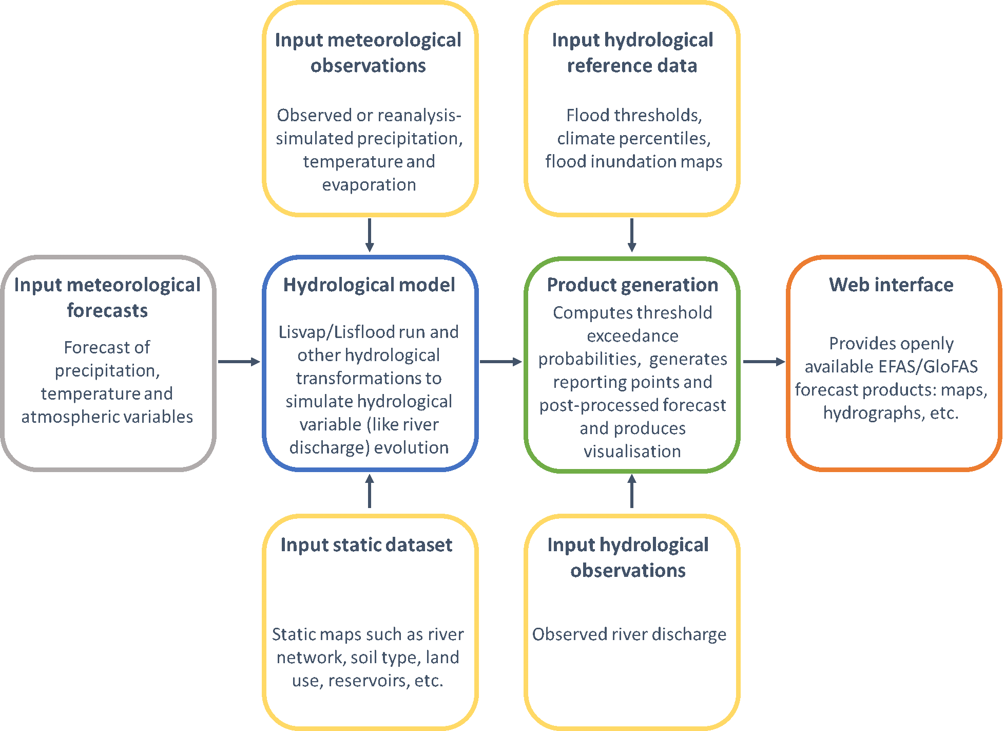
From GloFAS 3.1, GloFAS modelling chain is based on the LISFLOOD hydrological model forced by an ensemble of
meteorological forcings. A 5-day monitoring analysis of the latest observations, either based on the latest
ECMWF reanalysis when available, or day-1 of ECMWF ENS control forecast, is used to initialize the
forecasts, followed by medium and extended range ensemble forecasts up to 30 days from the ECMWF Integrated
Forecast System ENS. ECMWF-ENS is the ensemble forecast of ECMWF and consists of 51 members at ~18 km
resolution up to 15 days, increasing to 36 km from day 16 to 30. In GloFAS, the outputs of the 00:00 UTC IFS
medium-range runs are used daily for day 1 to 15, and the latest available IFS extended range runs used for
day 16 to 30.
The resulting simulated daily hydrological forecasts are compared with reference discharge runs obtained
from the same modelling chain. This results in a set of probabilities of exceeding pre-defined flood
thresholds of different severity.
GloFAS offers a range of forecast products and associated information, accessible via different layer tab of
the GloFAS map viewer:
GloFAS reference discharge runs are a collection of discharge simulations as close as possible to GloFAS
operational system.
GloFAS forecasts hydrological reanalysis GGloFAS hydrological reanalysis is set of
proxy-observation, deterministic time series of hydrological variables, including river discharge, produced
from atmospheric forcing as close as possible to observations, using the same modelling chain as in GloFAS
and GloFAS Seasonal to avoid the introduction of systematic biases. It is used as initial conditions of
GloFAS and GloFAS Seasonal reforecasts, to calculate discharge thresholds for GloFAS, and to conduct GloFAS
and GloFAS Seasonal forecast skill assessments
GloFAS reforecasts are forecast simulations performed for a set of past dates, based on a
configuration as close as possible to GloFAS operational setting, initialised using GloFAS hydrological
reanalysis. GloFAS reforecasts can be used to analyse GloFAS forecast skill systematically over a long
period.
GloFAS forecasts discharge thresholds are a set of maps of discharge magnitudes corresponding
to the 2-, 5- and 20-year return period floods (respectively called Medium, High and Severe Awareness
Levels). They are generated by fitting a Gumbel extreme value distribution to the annual maxima series
extracted from GloFAS discharge timeseries of the hydrological reanalysis using the method of L-moments.
GloFAS discharge thresholds are used to generate flood awareness forecast maps
GloFAS data is a gridded dataset at 0.1° horizontal resolution. It contains: