What is GloFAS?
- GloFAS 30-day, a daily hydrological forecast which provides a quick overview of upcoming flood events for the next 30 days
- GloFAS Seasonal, a monthly hydrological forecast which provides river flow outlooks highlighting unusually high or low river flow up to 16 weeks ahead
The aim of GloFAS is to complement relevant national and regional authorities and services, and to support international organisations in decision making and preparatory measures before major flood events (particularly in large trans-national river basins). GloFAS only focuses on rivers, and does not provide real-time forecast information on flash flood risk or coastal flooding, nor on inundated areas.
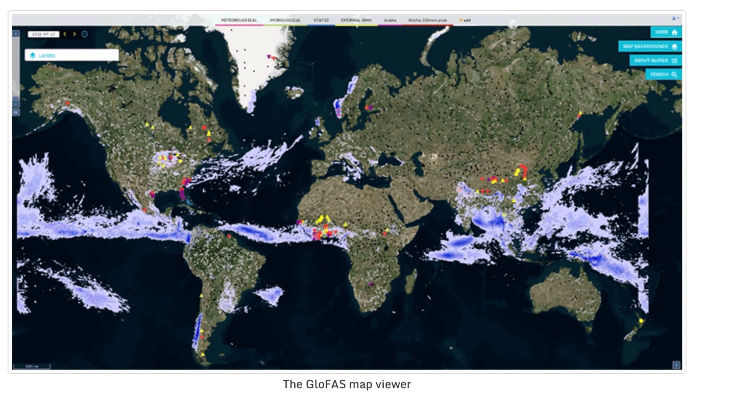
The GloFAS system is composed of an integrated hydro-meteorological forecasting chain and of a monitoring system that analyses and updates results daily (GloFAS 30-day) and monthly (GloFAS Seasonal). GloFAS forecasts of possible flood episodes and unusually high/low river flow for all major rivers of the world are shown through a dedicated web platform, the GloFAS map viewer.
GloFAS is designed as an operational tool for decision makers, including national and regional water authorities, water resources managers, hydropower companies, civil protection and first line responders, and international humanitarian aid organisations. It has become an operational service in April 2018, following a pre-operational phase started in 2011.

What forecast products does GloFAS offer?
GloFAS includes many different products for each of its services
-
River network probabilities
Probability of the streamflow forecast to exceed two pre-defined thresholds (5-year and 20-year floods) within the next 30 days.
-
River network flood summary
Maps of flood severity for three forecast periods within the next 30 days.
-
Threshold exceedance icons
Overall evolution of the flood severity and associated probabilities for the next 30 days.
-
Forecast hydrographs
Time evolution of streamflow probability forecasts for the next 30 days.
-
Consistency diagrams
Evolution of the forecast probabilities for three pre-defined flood severity thresholds in the last 5 daily GloFAS 30-day runs.
-
Precipitation maps
Ensemble median and probability of first 10-day precipitation forecast totals to exceed three pre-defined thresholds.
-
Rapid flood mapping
Estimated 1-km flood extent based GloFAS river discharge forecast and a catalogue of modelled inundation extents.
-
Rapid impact assessment
Potential impact of floods on population and land use (agriculture, urban) aggregated over administration regions.
-
River network probabilities
Maximum probability of high (> 80th percentile) or low (< 20th percentile) weekly-averaged river flow during the 4-month forecast horizon.
-
River basin probabilities
Maximum area-averaged probability of high (> 80th percentile) or low (< 20th percentile) weekly-averaged river flow over the basin during the 4-month forecast horizon.
-
Forecast hydrographs
Evolution of the weekly-averaged streamflow forecasts over the 4-month forecast horizon.
-
Consistency diagrams
Evolution of forecast probabilities to cross the high and low flow thresholds in the last 4 GloFAS Seasonal runs.
How are the forecasts produced?

The GloFAS system: Input data and parameters (yellow), modelling chain (blue) and dissemination interface (grey).
How can I see the forecasts?
GloFAS forecasts are freely accessible to all registered users through its web-mapping platform (www.globalfloods.eu). Register here.
GloFAS map viewer and GloFAS products are tailored to give a quick overview of current and future hydro-meteorological situation, and of the ongoing and upcoming flood events. Additional information including detailed evolution of streamflow forecasts is provided for over 2000 static reporting points, complemented with dynamically defined points in areas at risk of flooding, but for GloFAS 30-day, this service is only available outside the European domain.
GloFAS map viewer is updated daily to automatically display the latest available GloFAS forecasts.

The GloFAS map viewer
What is the skill of GloFAS forecasts?
Forecast verification is important to understand the strengths and weaknesses of a forecast system and to build confidence in results. It also provides additional information to help decision makers to assess how they can use GloFAS products to make decisions.
The overall GloFAS forecast performance is summarised using a set of skill scores which highlight different aspects of forecast skill, summarised in the dedicated GloFAS 30-day and GloFAS Seasonal pages. GloFAS performance is also regularly evaluated for specific events and case studies.

Example of global skill assessment results for GloFAS 30-day v2.1 for lead time 5 days
How can I access the data behind the forecasts?
- Web Map Service Time (WMS-T) for geospatial products, that provides access to www.globalfloods.eu layers in a GIS environment.
- Tailored ftp service, on request sent to info@globalfloods.eu.
- Direct data download expected during 2020 through the ECMWF Meteorological Archival and Retrieval System (MARS) and the Copernicus Climate Change Service Climate Data Store.
How does the GloFAS service evolve?

GloFAS development cycle
How can I contribute to GloFAS?
There are many ways to get involved with GloFAS, from becoming a collaborator, contributing to the community learning framework, providing data or participating to regular workshops. Please go to the Get involved pages to learn more.
What is Copernicus Emergency Management Service?
- meteorological hazards
- geophysical hazards
- deliberate or accidental man-made disasters
- humanitarian disasters
The mapping component of the service (Copernicus EMS - Mapping) has a worldwide coverage and provides accurate geo-spatial information derived from satellite remote sensing and is completed by available in situ or open data sources.
The early warning component of the Copernicus EMS consists of three different systems:
- The European Flood Awareness System (EFAS) and Global Flood Awareness System (GloFAS)
- The European Forest Fire Information System (EFFIS), which provides near real-time and historical information on forest fires and forest fire regimes in the European, Middle Eastern and North African regions
- The European Drought Observatory (EDO), which provides drought-relevant information and early-warnings for Europe