GloFAS 2.1 system upgrade to 2.1
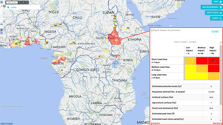
On 5 November 2019, GloFAS was upgraded to version 2.1. This included an upgrade of the hydrological reanalysis based on ERA5 (official release) openly available to users through the Copernicus Climate Data Store, a new set of reforecasts (GloFAS 30-day from 1998-2019 and GloFAS-Seasonal from 1981-2017) and upgraded thresholds used to highlight flood events. In addition, the GloFAS map viewer now includes new products such as global flood risk assessment (summary flood extent and flood impact overview), and flood summary maps to help users to interpret the forecasts. Finally, new ancillary maps are also provided: reservoir impact, upstream area, major rivers and administrative regions. More details available on the dedicated wiki pages (https://confluence.ecmwf.int/display/COPSRV/GloFAS+v2.1)
By Gabriele Mantovani Nov. 5, 2019, 12:56 p.m.