Implemented by the European Commission as part of the Copernicus Programme
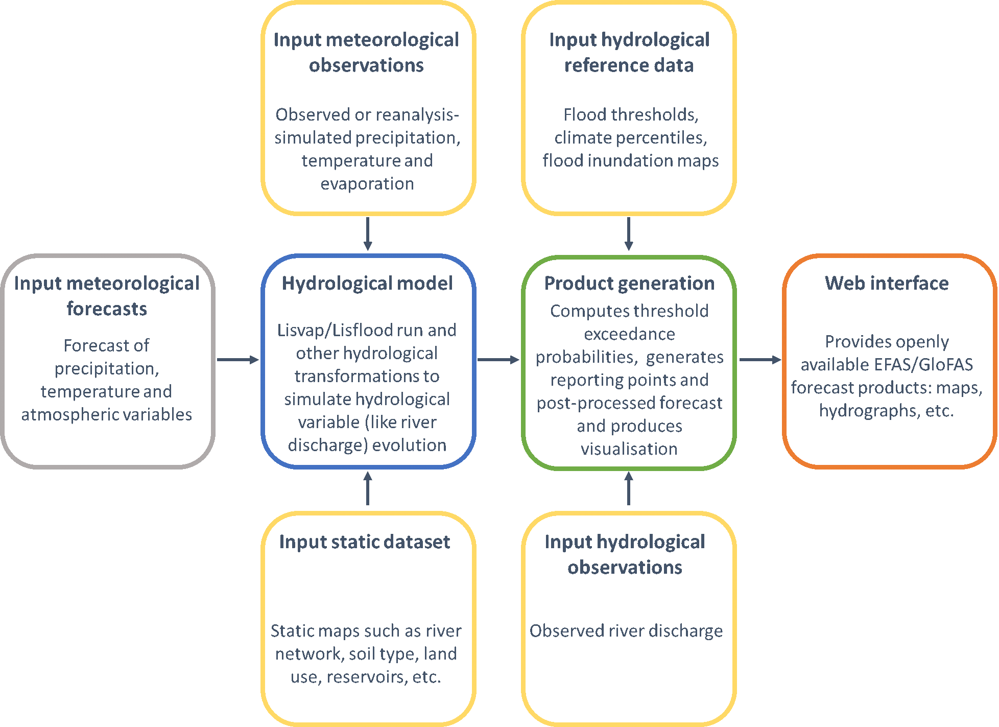
From GloFAS 3.1, GloFAS Seasonal modelling chain is based on the LISFLOOD hydrological model forced by an
ensemble of meteorological forcings. A 5-day monitoring analysis of the latest observations based on the
latest ECMWF reanalysis when available is used to initialize the forecasts, followed by seasonal ensemble
forecasts for 16 weeks from the latest ECMWF Seasonal Forecast System, SEAS5. The resulting 16 weeks
simulated daily hydrological forecasts are then averaged by calendar weeks (GloFAS Seasonal) and compared
with GloFAS Seasonal reforecasts to create an ensemble of weekly river flow anomalies, converted into a
probability of unusually high of low flows.
GloFAS Seasonal offers a range of forecast products and associated information, accessible via different layer tab of the GloFAS map viewer:
GloFAS Seasonal reference discharge runs are a collection of discharge simulations as close as possible to
GloFAS Seasonal operational system.
GloFAS Seasonal reforecasts are forecast simulations performed for a set of past dates
using the latest ECMWF Seasonal forecasting system, based on a configuration as close as possible to GloFAS
Seasonal operational setting, initialised using GloFAS reference long run. They are used to compute GloFAS
Seasonal reference discharge runs and to analyse GloFAS Seasonal forecast performance systematically over a
long period.
GloFAS Seasonal discharge thresholds are a set of maps of weekly-averaged discharge
magnitude corresponding to the 20th and 80th percentile values (respectively called low and high flow
thresholds). There is a set of maps for each week of the year and each lead time from 1 week to 16 weeks.
The percentiles are derived from GloFAS Seasonal forecast reruns for the corresponding week of the year and
lead-time sample. GloFAS Seasonal discharge thresholds are used to generate river flow anomaly forecast
maps.
GloFAS Seasonal data is a gridded dataset at 0.1° horizontal resolution. It contains: